- About Us
- Our Work
- Resources
- Get Involved
- Blog
- Support Us
By Canopy Team on January 8, 2021
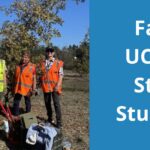
Identifying suitable planting sites for a neighborhood tree planting takes time and resources, especially when Canopy begins work in a new area. There are many steps before planting begins: finding residents eager to accept and care for trees, obtaining permission from landlords if necessary, identifying sites free of infrastructure conflicts, selecting appropriate species with residents, and then—finally—sourcing and planting the trees themselves.
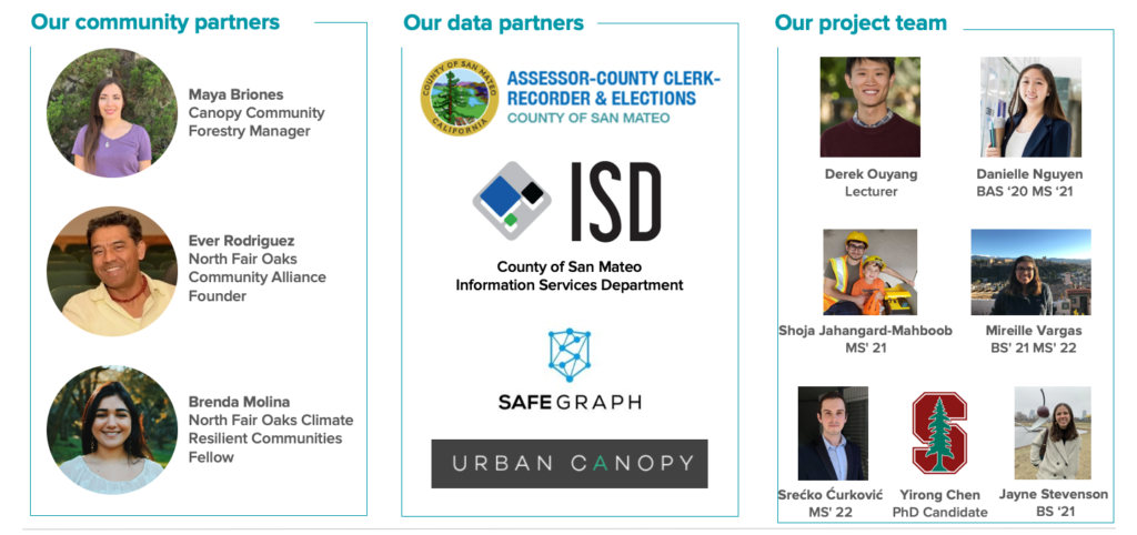
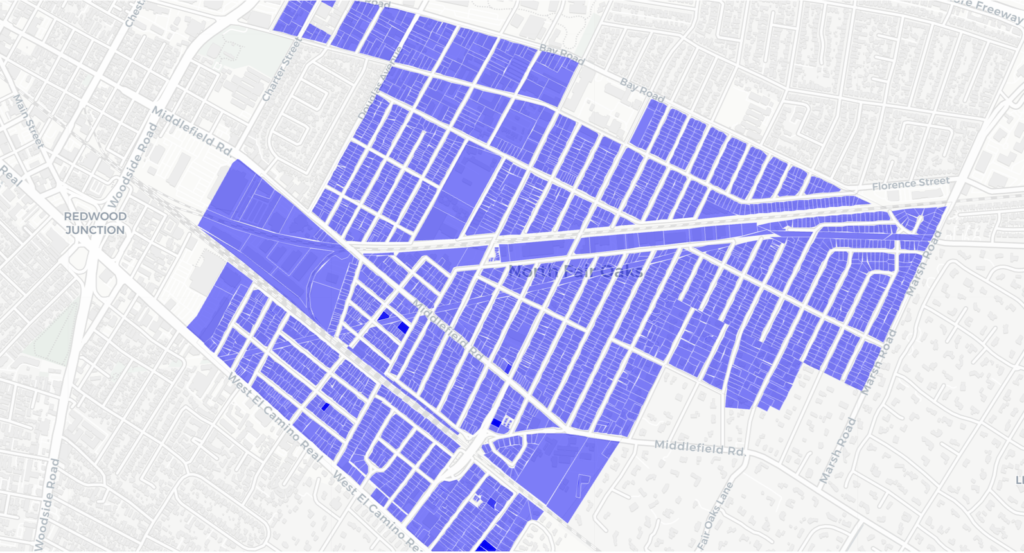
In fall 2020, Canopy connected with Stanford Future Bay Initiative (SFBI) along with community partners at North Fair Oaks Community Alliance (NFOCA) and Climate Ready North Fair Oaks. With input from Canopy and data from local government, Stanford students at SFBI developed a hyper-local mapping tool, designed to focus Canopy’s canvassing and outreach efforts where they are most likely to yield results.
The tool assigns a “score” to each individual parcel in North Fair Oaks. The score is based on six factors, and users can adjust the weight of each factor depending on the planting priority.
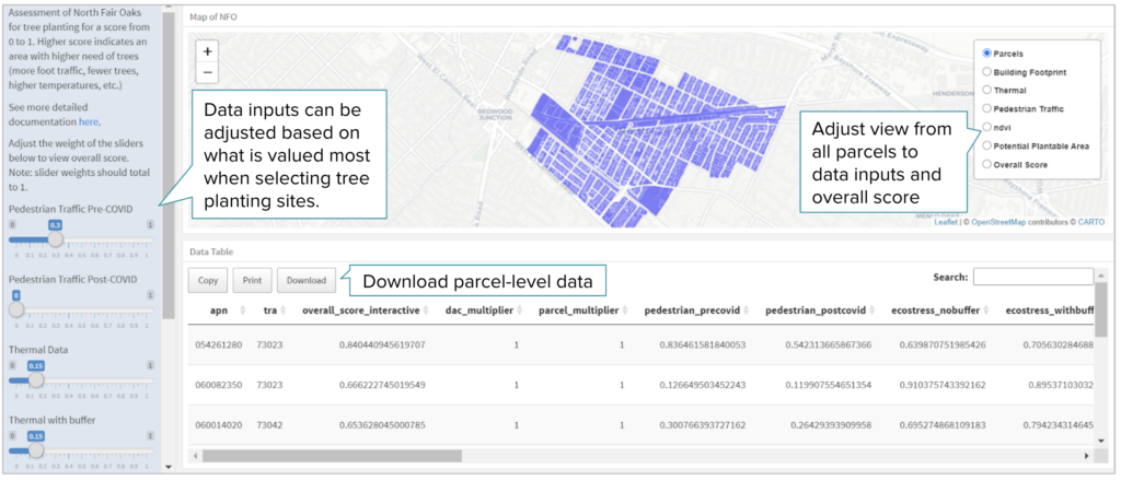
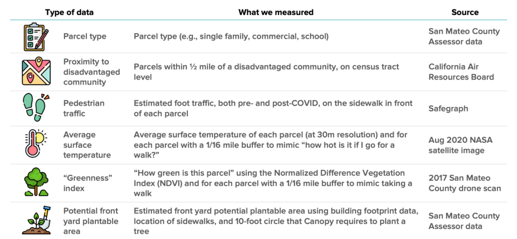
Here’s how the SFBI team describes their data inputs:
For Canopy’s planting efforts, a parcel receives a high score if is is within or near a disenfranchised community, has a lot of foot traffic, is in a hot area, lacks existing greenery, and is likely to have planting space. In other words, sites where new trees could bring the most public benefit in shading, cooling, nature access, and equity.
Maya Briones leads Canopy’s planting efforts in North Fair Oaks and worked with the Stanford team to develop the tool. “They really worked with me and tailored this tool to what I wanted and what I thought would be helpful for my program, which was amazing,” she shares. “I have used it quite a bit, especially the overall score and the plantable area score when planning out future plantings.”
Creating data-driven programs where on-the-ground knowledge goes hand-in-hand with careful data analysis is a powerful way to deepen local impact.
The team is quick to point out that data analysis is still just one part of the process; there’s no replacement for on-the-ground canvassing, but this tool is meant to focus those resources where they can have the most impact.
“My key takeaway from project has been that without community partners like Canopy you can’t get this work done,” shares Jena Louie, one of several Stanford graduate students who worked on the project. “We’ve had so many types of data analysis that we’ve run, we’ve put together this mapping tool, but it’s all meaningless unless you have someone out here talking to residents and convincing them of the importance of this work and the need to plant trees.”
But when data analysis and grassroots outreach go hand-in-hand, the whole community can benefit.
Canopy, Stanford Future Bay Initiative, and partners see potential for this project to have an impact beyond Canopy’s programs in North Fair Oaks.
In February, they’ll present their model to the Sustainable Urban Forests Coalition, and the team is in touch with other organizations working on tree mapping projects.
“I hope that this mapping tool has significant impact not only with Canopy here on the Midpeninsula but also with other nonprofits doing similar work,” says Jena. “With growing attention on the need for trees in neighborhoods, there’s a lot of momentum for tools like this. By coming together, we can make the world a more forested, beautiful place.”
Based on this successful model developed in collaboration with Canopy, the Stanford Future Bay Initiative Lab has shared the tool with other agencies and organizations, and a modified version has been adopted by Santa Clara County, City of San Jose, and other local nonprofits.
“Having more institutions using this tool offers so many opportunities,” reflects Maya. “Not only because the map can support the work of all these different agencies, but also in terms of collaboration and knowledge-sharing among groups working to improve public health and equity.”
In March 2021, Maya and students from Stanford Future Bay Initiative presented their tool at the Sustainable Urban Forests Coalition annual conference. Watch the recording for a closer look at the map and potential next steps: