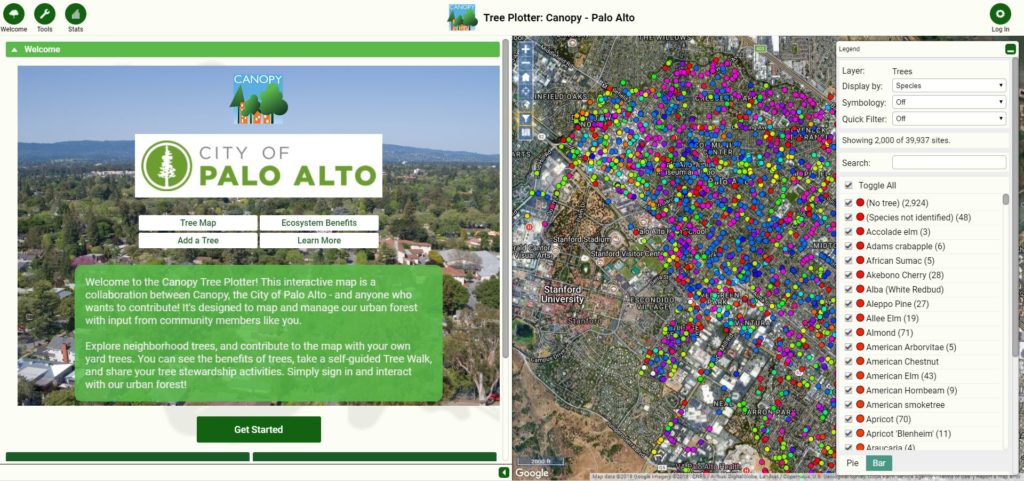
The Canopy Tree Plotter is a collaboration between Canopy, the City of Palo Alto, and anyone who wants to contribute! Tree Plotter is a tree inventory software created by Plan-it Geo, a company that specializes in trees and technology – how perfect for the bay area!
This customized advanced tool will enhance Canopy’s tree planting and tree care management, and improve how volunteers conduct the annual Young Tree Care Survey and The Great Oak Count.
It’s also a user-friendly experience for tree stewards and enthusiasts to better understand our tree neighbors. You can access the map on your computer, tablet, or smartphone; all you need is an internet connection and you’re ready to explore and use the map.
What can you do in the Canopy Tree Plotter?
Explore our urban forest
Take a self-guided Tree Walk: gain a deeper understanding of a variety of native and novel trees.
Learn more about Palo Alto’s trees: we have the City of Palo Alto’s public tree inventory and Canopy-planted trees from our many community initiatives, so users can learn more about the trees along streets and in parks.
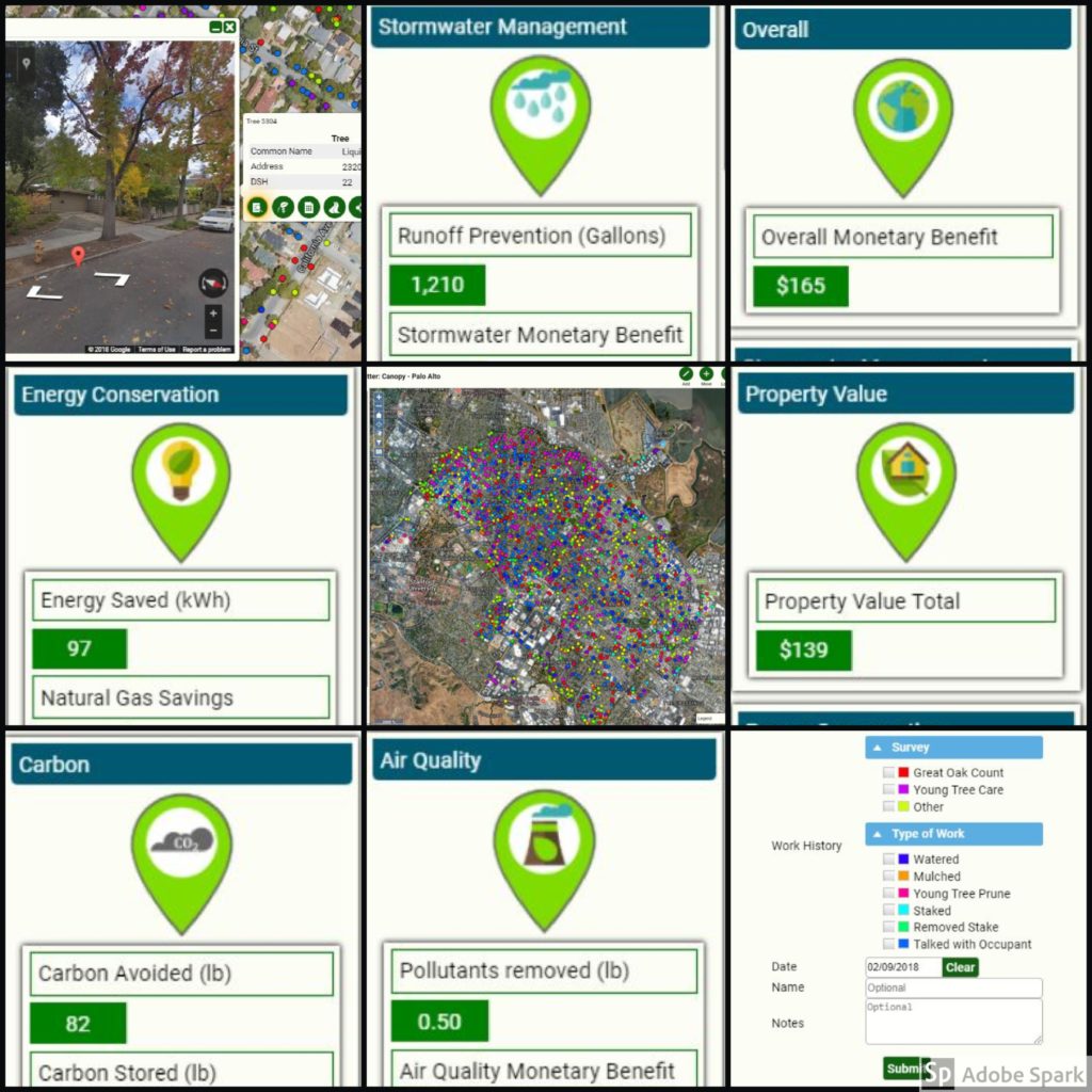
View annual Ecosystem Benefits: see how individual trees and the forest as a whole pay us back by improving air and water quality, conserving energy, and even raising property values.
Contribute to the map by adding your own yard trees
Plot your yard trees, add tree photos, and feel free to share on social media!
Private yard trees account for more of our tree canopy than street and park trees, and we want to know much more about these valuable and beloved trees.
Track your tree care activities
Keep track of your tree care activities such as watering and mulching, and show others that it’s easy to be a tree steward.
Using Tree Plotter is easy and FUN
There are so many interesting features in our Canopy Tree Plotter map that connect users to up-to-date information about the trees around us. Simply open up your web browser, sign in, and interact with our urban forest!
Tutorials and basic information
Below we have provided a brief tutorial to show you how to navigate some of the map features. We recommend using Google Chrome on your smartphone, desktop computer, or tablet to have the best experience.
Help with Tree Plotter
If you have watched the tutorial videos above and are still having trouble using Tree Plotter, here are some ways to get help and notify us of issues.
There are two ways to reach out to Plan-it Geo about a problem in the map. You can send an email to [email protected], or navigate in the map: Tools>The Basics>Support and type in your message.
Email Canopy at [email protected] and a staff member will get back to you. We are open to suggestions from the public and volunteers about ways to improve Tree Plotter.
Sign up for local tree news, events, volunteer opportunities, and more.