- About Us
- Our Work
- Tree Info
- Get Involved
- Blog
- Support Us
By Canopy Team on February 5, 2018
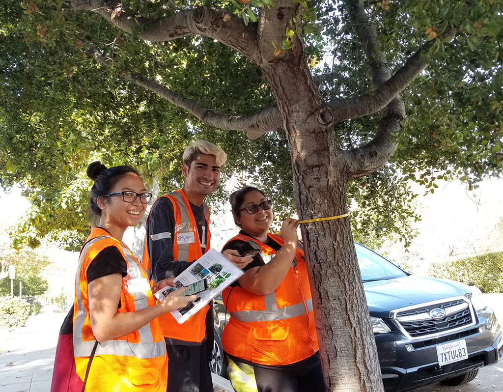
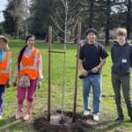
Volunteers using Tree Plotter to plot native oaks for The Great Oak Count.
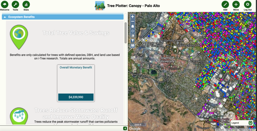
Ever encountered a tree you wanted to learn more about? Or where you could find the nearest valley oak? Or perhaps you’ve wondered about the value of the benefits that trees bring to your neighborhood?
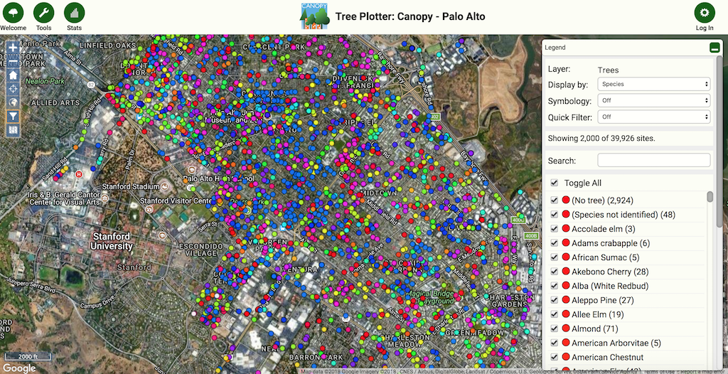
Those answers are now in your reach with Canopy’s interactive Tree Plotter map. In partnership with the City of Palo Alto and Plan-it Geo we have developed a customized mapping tool that features the City’s street tree inventory and Canopy-planted trees. The map is also being used to record the location of native oaks throughout Palo Alto as part of The Great Oak Count. And soon the map will contain private yard trees with the help and contribution from the community!
Building the map was a joint effort between Plan-it Geo, Community Urban Forestry Program Manager Elise Willis, and our award-winning volunteer, Jeff Greenfield. To get a behind the scenes look and to learn more about the making of Canopy’s Tree Plotter map, we interviewed Elise Willis.
Canopy: We are thrilled to open this map up to the public! Can you tell us a little about what went into creating the customized Tree Plotter map?
Elise: Lot’s of dedication and perseverance! Myself, some other Canopy staff, and a wonderful volunteer, Jeff Greenfield, have spent many hours researching, testing, and trying to build an intuitive, fun, and useful map for Canopy and the public to use. It’s a long awaited platform that we hope will engage the public in exploring our urban forest as well as help Canopy run our programs even better and ultimately benefit our urban forest. We’re really excited about Tree Plotter! We can’t wait for people to start playing with it.
Canopy: What will folks be able to do with the Tree Plotter map?
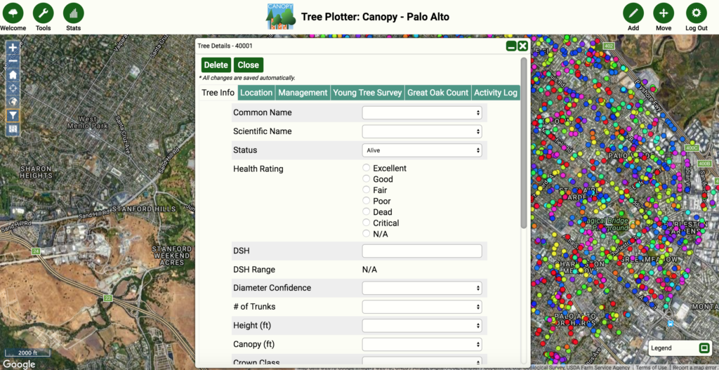
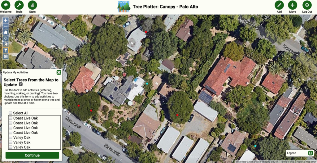
Elise: Users can do several things on the map now and even more in the future. Right now we are encouraging the public to add their yard trees to Tree Plotter. This is information that we not only think will be fun to put in the map, but it is also useful as yard trees contribute more tree canopy cover than even street and park trees. When people add their yard trees they can add species, size, when they planted it, and even photos.
We are also inviting people to track their tree care activities so we can show everyone that it is easy to mulch, water, and overall be great stewards to the trees around you. Some other things you can do is volunteer with Canopy in several of our programs, and learn how to use the map in even more advanced ways. And anyone can share trees on social media! Through the map you can like trees and share them on Facebook, Linkedin, and Twitter.
Canopy: What’s coming up next for Tree Plotter?
Elise: Coming up next we are very excited to put our Canopy Tree Walks on the map. Tree walks are really popular and we want people to be able to use Tree Plotter for self-guided walks, so that’s rolling out soon.
We are also customizing it for a couple really exciting volunteer programs. One is The Great Oak Count and this is an effort to engage volunteers to survey all of the native oaks throughout Palo Alto, and then in the summer we are going to be using this for our annual Young Tree Care Survey in which volunteers survey the young street trees throughout the City and we report how they’re doing.
It’s great to be able to use this new technology to make the data collection fun and speedy. And finally, we’ll be uploading some other interesting groups of trees like Canopy-planted trees, Mayor’s trees, heritage trees, and all kinds of other trees that people may find interesting to learn more about.
Thanks for sharing Elise! This is an exciting project and we can’t wait for the community to get involved. We invite you to visit the Canopy Tree Plotter map, create a login, and explore all the interactive features that are available.
Learn more about the map and how to use it over at the Canopy Tree Plotter webpage. There you can check out Tree Plotter video tutorials and get started with the map in a few quick steps.